

Although it is the same country, the temperature and the atmosphere can vary considerably in Mexico. Specialists from the Ministry of Environment and Natural Resources (Semarnat) indicate that there are at least seven climates predominant in the territory.
Warm subhumid, dry and semi -discharge, very dry or dry desert; With less surface the climates: warm wet, subhumid temperate, humid and cold temperate with the minimum surface, are the types of climates that dominate in the national territory.
Depending on the season of the year there may be rains, showers, sunny days or even more than one type in the same day, so the below is the forecast of this May 4.
The frontal system no. 41 will be extended over the north and northeast of the national territory, in interaction with the current in subtropical jet and divergence, it will cause strong, hopper winds and refreshing of daytime temperatures in these regions. In turn, strong to very strong rains are foreseen accompanied by electric shocks and hail fall in Coahuila, Nuevo León, Tamaulipas and San Luis Potosí; In addition to showers in Chihuahua.
In the course of the afternoon, the new cold front (No. 42) will enter the north of Baja California, in interaction with a polar trough and the currents in polar and subtropical jet, they will originate strong winds to very strong with hoppers in the northwest of the country; as well as rains and showers in Baja California.
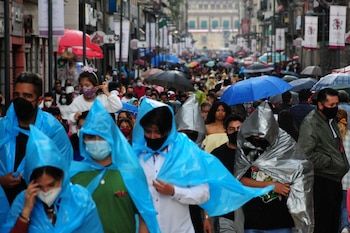
Low pressure channels will be extended over the center, the East and Southeast of the Mexican Republic, coupled with divergence and moisture entry of the Pacific Ocean, Gulf of Mexico and the Caribbean Sea, will cause showers and heavy rains with electrical discharges and possible hail fall in the aforementioned regions, in addition to the south of the country; predicting very strong punctual rains in Puebla and Veracruz.
An anticyclonic circulation in medium levels of the atmosphere will maintain hot to very hot atmosphere over the Mexican territory, the heat wave prevailing in areas of Jalisco (center, southwest and south), Colima (Northeast), Michoacán (west, center and east), Guerrero (Northwest and North), Oaxaca (Central and South), Chiapas (Southeast) and More.
In turn, it begins heat wave in the states of Querétaro (central and south), Puebla (north and south), State of Mexico (southwest), Hidalgo, Mexico City, Tlaxcala, Campeche, Yucatán and Quintana Roo.
The aforementioned weather systems will cause the following effects:
Strong rains with very strong punctuals (50 to 75 mm): Nuevo León, Tamaulipas, Puebla and Veracruz.
Chubascos with strong punctual rains (25 to 50 mm): Coahuila, San Luis Potosí, Querétaro, Hidalgo, Tlaxcala, Oaxaca and Chiapas.
Chubascos intervals (5 to 25 mm): Baja California, Chihuahua, State of Mexico and Mexico City.
Isolated rains (0.1 to 5 mm): Michoacán, Guanajuato, Morelos, Tabasco and Quintana Roo.
Wind of 40 to 50 km/h with gusts of 60 to 80 km/Hy hoppers: Baja California and Sonora.
Wind of 20 to 40 km/h with streaks of 50 to 70 km/hypenerras: Chihuahua, Durango, Zacatecas and Aguascalientes.
Wind of 20 to 30 km/h with gusts of 40 to 60 km/h: Coahuila, Nuevo León, Tamaulipas, San Luis Potosí, Veracruz, Guerrero and Oaxaca; With hoppers: Baja California Sur.
Wind of 10 to 20 km/h with gusts of 30 to 50 km/h: State of Mexico, Mexico City, Campeche, Yucatán and Quintana Roo; With hoppers: Sinaloa, Nayarit, Jalisco, Colima, Michoacán, Guanajuato, Querétaro, Hidalgo, Puebla and Tlaxcala.
Wave of 1.5 to 2.5 meters high: western coasts of the Peninsula of Baja California, coasts of Jalisco, Colima, Michoacán, Guerrero, Oaxaca, Chiapas, Tamaulipas and Veracruz.
Maximum temperatures 40 to 45 ° C: San Luis Potosí (South), Querétaro, Hidalgo, Jalisco (Central and South), Michoacán (East, Centro and West), Morelos, Guerrero (Northwest and North), Oaxaca (North and Center), Veracruz (South), Tabasco (West and North), Campeche and Yucatán (West).
Maximum temperatures 35 to 40 ° C: Chihuahua (Southwest), Coahuila (Southwest), Nuevo León (South), Tamaulipas (Central and South), Zacatecas (South), Durango, Sinaloa, Nayarit, Colima, Aguascalientes, Guanajuato, State of Mexico (Southwest), Puebla (North and Southwest), Quintana Roo and Chiapas (West).
Maximum temperature 30 to 35 ° C: Sonora, Baja California Sur and Mexico City.
Minimum temperatures of -10 to -5 ° C with frost for Sunday morning: mountainous areas of Chihuahua and Durango.
Minimum temperatures of -5 to 0 ° C with frost for Sunday morning: mountainous areas of Baja California and Sonora.
Minimum temperatures of 0 to 5 ° C for Sunday morning: High areas of Zacatecas, Michoacán, State of Mexico, Tlaxcala and Puebla.
Because climatic conditions They can change, the authorities recommend the population to remain informed and at the slope of any situation that could occur during the day.
Civil defense Local will be responsible for reporting in case an event could be registered that endangers citizens.


