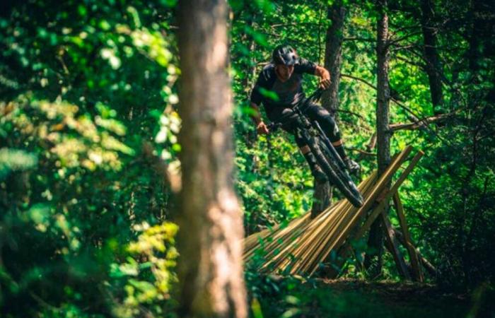
The Matarraña region will begin this year the construction of a Bike Park in FuentesPaldaa project framed in its commitment to foster cycotourism as a sustainable territorial development strategy. The works have already been tendered for 134,440 euros and once they are awarded, the company will have six months to execute them. Specifically, the supply of tourist services of Matarraña will be expanded creating several circuits of the Downhill Mountain Bicycle Modality, which consists of the descent by circuits conditioned with different levels of technical difficulty. The ascent will be made by vehicles by a forest track.
The new facilities will form the first Bike Park DH of the province of Teruel and the border provinces as highlighted in the project. In Aragon there are only two in the province of Huesca, Panticosa, open only in July and August; and that of Gavín, both more than three hours away from FuentesPalda. Therefore, a great reception is expected among the users of Zaragoza, Teruel, Catalonia and Community Valencian. The goal is that your Opening throughout the year and free access to circuits will facilitate the constant presence of specialized cyclists, increasing the number of overnight stays and the consumption of tourist services in the area.
The project aims to create a permanent bike that will start from a new Blue line (Sounding instead) that will become the main axis of the park and be suitable for the non -specialist public, which will allow expanding the range of users to cyclists from XC and Enduro modalities in addition to the family audience. At the same time, they will be creatednew lines, a red (corb) and a black (matabikers)which will start from the same access track and end half the blue route.
Currently, there is only a narrow path of descent in what will be the future red line, manually conditioned in recent years by local cyclists. The routes will take place on the natural soil, will be beaconed and will only be down. At both ends of each circuit, warning signaling will be installed for cyclists and other users of the mountain, warning that it is a circuit in which bicycles can descend at a certain speed, so it can be dangerous to circulate through the routes. The circuits will not be fenced, so Access to them will be free. Therefore, it is not a private use of the mountain.
The type of route of bike park routes is Progression in descent with greater or lesser slope In most of the paths, with the exception of the connection between the end of the blue circuit and the parquin of vehicles (located next to the municipal swimming pools), which will consist of the transit by the current GR 8 path, in a relatively flat, wide and shared section with the hikers, in which it will be necessary to pedal a few minutes after finishing the descent. It is intended that Blue line be as simple as possible and accessible to an audience with little experiencein order to expand the number of visitors. The red and black lines will be alternative sections To blue To achieve greater difficultyfor which they will have mandatory elements, such as jumps and steps, which do not appear in the simplest circuits. Thus, the black line can be used for DH competitions in the future.
The bike trial will be placed On the slopes of the area known as El Pinar, at an altitude between 1,020 and 750 meters. The access from Fuentespalda at the beginning of the descent will be made by means of an open traffic forest track in a very good state, suitable for vehicles cars, which was repaired for the construction of the zip line. On this track several signals will be installed indicating the Bike Park, and access to the different lines will be conveniently signaled. The user parking will be in the PARQUIN OF THE MUNICIPAL POOLSat the end of the routes. It is not necessary to condition more accesses.
The removal to the start of the circuits can be done by own means or hiring a local taxi/trace service. Of the lines can only be evacuated in two moments: when they cross the forest track located at the top, and at the end of the blue line by the agricultural track that gives access to the nearby fields. Therefore, it is expected that The first half of the blue line is accessible with small 4 × 4 vehicles (quad, motorcycles) so that there is a simpler intermediate access in case of an accident. This will facilitate evacuation work by rescue equipment if necessary. The total length of the action (in plant) is 2,400 m, which are distributed as follows: 1300 m. For the blue line, 500 m. for the black line and 600 m. For the red line. For the decline lines it is considered a useful width of 3.0 m throughout the route, so it is a total area of 7,200 m2 for the action. A width of the 3 m route is estimated, when trying to look for circuits with the least possible difficulty, where it is important to give greater width to facilitate bicycle descent.


