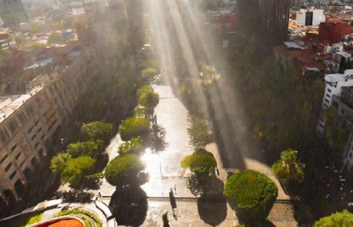
The national Meteorological Service (SMN) from Mexico provides daily reports on the climatic conditions in diverse regions of the country. This service is essential for citizens to prepare for possible CLIMATE CHANGESsuch as heavy rains, hail or sunny days.
Mexicoknown for its temperate climate, experiences significant variations in its weather conditions depending on the region and the season. Therefore, the SMN is responsible for offering precise forecasts that allow the population to anticipate the conditions of time and take the necessary precautions.
Access to Reliable weather information It is crucial to plan daily activities and avoid unpleasant surprises caused by sudden changes in the weather. SMN forecasts help mitigate the risks associated with extreme meteorological phenomena, protecting both people and their assets.
A dry line in the north of the country, in interaction with a thexed in height, divergence and with the currents in polar and subtropical jet, will cause strong winds with streaks of 50 to 70 km/h with hoppers in Chihuahua, Durango and Zacatecas and with possible formation of whirlpool, show Coahuila, Nuevo León and Tamaulipas. It is expected that the trough in height moves over the center of the United States during the afternoon, ceasing to affect Mexico.
In turn, low pressure channels, in combination with the entry of moisture of the Pacific Ocean, Gulf of Mexico and the Caribbean Sea and divergence, will cause rains and showers with electric shocks and possible fall of hail in the center, East, south and southeast of the national territory, with heavy rains in Hidalgo, State of Mexico, Tlaxcala and Puebla and very strong punctual in Chiapas.
On the other hand, an anticyclonic circulation in medium levels of the atmosphere will maintain a hot to very hot atmosphere in the Mexican Republic. Likewise, the heat wave will prevail in areas of Jalisco (Central, South and Southwest), Colima (East and Northeast), Michoacán (West, Southwest, Central and Southeast), Guerrero (Northwest, North, South and Southeast), Oaxaca (Southwest and South), Chiapas (Central and West) and Morelos.
The aforementioned weather systems will cause the following effects:

Strong rains with very strong punctuals (50 to 75 mm): Chiapas. Chubascos with strong punctual rains (25 to 50 mm): Nuevo León, Tamaulipas, San Luis Potosí, Hidalgo, State of Mexico, Tlaxcala and Puebla. Chubascos intervals (5 to 25 mm): Coahuila, Guanajuato, Querétaro, Mexico City, Morelos, Michoacán, Guerrero, Oaxaca and Veracruz. Isolated rains (0.1 to 5 mm): Campeche, Yucatán and Quintana Roo.
Wind of 30 to 40 km/h with gusts of 50 to 70 km/hy themselves: Chihuahua, Durango and Zacatecas; and with possible formation of whirlpools: Coahuila, Nuevo León and Tamaulipas. Wind of 20 to 30 km/h with gusts of 40 to 60 km/h: Campeche and Yucatán; With hoppers: San Luis Potosí, Aguascalientes and Jalisco. Wind 10 to 20 km/h with gusts of 30 to 50 km/h: Guerrero, Oaxaca, Chiapas, Veracruz, Tabasco and Quintana Roo; With possible hoppers: Baja California, Baja California Sur, Sonora, Sinaloa, Nayarit, Colima, Michoacán, Guanajuato, Querétaro, Hidalgo, Puebla, Tlaxcala, State of Mexico, Mexico City and Morelos.
Wave of 2.5 to 3.5 meters high: western coast of Baja California, coasts of Jalisco, Colima and Michoacán. Wave of 1.5 to 2.5 meters high: Western coast of Baja California Sur, coasts of Sinaloa, Nayarit, Guerrero, Oaxaca, Chiapas, Tamaulipas, Veracruz, Tabasco, Campeche, Yucatán and Quintana Roo.
Maximum temperatures 40 to 45 ° C: Sinaloa (center), Durango (west), Jalisco (central and south), Michoacán (east and west), Guerrero (northwest) and Oaxaca (center). Maximum temperatures 35 to 40 ° C: Sonora, Chihuahua, Coahuila, Nuevo León, Tamaulipas, San Luis Potosí, Zacatecas, Nayarit, Colima, Aguascalientes, Guanajuato, Querétaro, Hidalgo, State of Mexico (Southwest), Morelos, Puebla (Norte and Southwest), Veracruz, Tabasco, Chiapas, Campeche, Campeche and Quintana Roo. Maximum temperature 30 to 35 ° C: Baja California and Baja California Sur.
Minimum temperatures of -10 to -5 ° C with frost for Thursday morning: mountainous areas of Chihuahua and Durango. Minimum temperatures of -5 to 0 ° C with frost for Thursday morning: mountainous areas of Baja California and Sonora. Minimum temperatures of 0 to 5 ° C for Thursday morning: Zacatecas, Michoacán, State of Mexico, Tlaxcala and Puebla areas.
In the event that the authorities consider that any of the climatological events It could be dangerous for the population, they will give the appropriate notice for people to protect themselves and carry their important objects.
Civil defense It will be responsible for informing citizens before any natural danger, as well as helping in case a tragedy has occurred.


