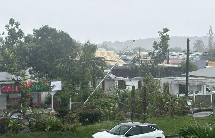
Roiled roofs, trees lying on the ground, as well as electric wires … A mini-tornado sowed terror in Baie-Mahault, shortly after 2:00 p.m. this Sunday. The weather has deteriorated again. Guadeloupe is, once again, after Saturday noon, placed in orange meteorological vigilance for “heavy rain and thunderstorms”.
The dread within part of the population of Baie-Mahault in the middle of the afternoon, this Sunday, May 4, 2025. A whirlwind of wind, similar to a small tornado, caused significant damage to residential neighborhoods, especially in Belcourt and in the town.
A swirling wind sowed terror in Baie -Mahault – 04/05/2025. • © Amateur Video
A swirling wind sowed terror in Baie -Mahault – 04/05/2025. • © Amateur Video
The Departmental Fire and Rescue Service (SDIS) has received several calls on this subject. For the time being, no victim is reported, but electric wires are on the ground and roofs have been damaged, in particular.
A swirling wind sowed terror in Baie -Mahault – 04/05/2025. • © Amateur Video
A resident of Belcourt had the window of her kitchen broken by debris projected by the whirling burst.
Sheets from roofs stolen in the sky before falling back, representing a serious danger for local residents.
Sheets were torn off from the roofs – 04/05/2025. • ©Florence Peroumal
Trees had branches torn off, or even have been uprooted.
This past episode will come for the time to assess the damage.
Already, the rectorate signals degradations within the school “Louis Andréa”; The roof of an annex premises, that of the infirmary, flew away. In addition, cables have been torn off, so that the electricity was cut.
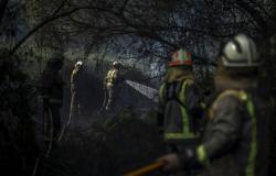
The firefighters quickly started the summary clearing of the impacted sites.
As a safety measure, a breaking of a part of the power supply of the
Bourg de Baie-Mahault was operated around 4:00 p.m. Three technicians from EDF Archipel Guadeloupe are currently on the foot of a work, E in the field, to establish a complete diagnosis of the situation and secure any risk areas. In this context, EDF calls for the greatest vigilance and reminds the whole population not to touch the electric cables even fallen to the ground and provides customers with the troubleshooting number: 0590.82.43.00 (24 hours a day). The agents are mobilized to ensure a return to normal as soon as possible.
Regarding this mini-tornado, the climatologist Christophe Valère-Montout de Météo France talks about an exceptional event, possibly from a “Navy“However, the archipelago is in an area favorable to the development of this type of phenomenon, after the United States and Australia. 1500 sea tubes are observed locally each year, mainly by fishermen, at sea.
It is the fact that they arrive on the ground, with such power, which is rarer.
The one who concerned Baie-Mahault is estimated at F1 level on the Fujita scale (moderate winds from 116 to 179 km/h). It is even possible that there have been several simultaneously, in the area.
The navy trompe is a column of air mixed with rotation water, forming a cloudy funnel, under a convective cloud above a water area. These micro-scaling phenomena form when the conditions are very unstable, while cold air passes over hot waters. Generally less intense than a tornado, they dissipate once on earth. There are two types: cold air and tornadoes (source: techno-science.net).
A mass of wet and unstable air, carrying a rainy activity locally marked, continues to affect the Guadeloupe archipelago. These punctually stormy showers are not very mobile, given the weakness of the Alizé. At the beginning of the afternoon, strong showers, sometimes stormy, occur on the large marine cul-de-sac, overflowing on the north of Basse-Terre. Others occur under the wind of Marie-Galante, even on the relief of the South Basse-Terre.
Strong intensity and sometimes stormy showers can still be triggered quickly, today and can generate significant combination of rain reaching, or even exceeding, 80mm of rain in 3 hours. Temporary floods are therefore to be feared.
No sector is, a priori, sheltered from the threat.
The most exposed regions remain the Basse-Terre and the municipalities bordering the Grand Cul-de-Sac Marin.
Rainy and stormy activity could continue until evening, even at the start of the night.
Here are the accumulations of rains noted in the pluviometers of Météo France, on the last hour:
- 21.7 mm in Sofaia Sainte-Rose ;
- 11.7 mm in Capesterre-Belle-Eau;
- 7mm in a small town.


