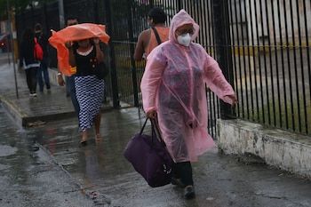
He climate tempered predominates in Mexico; However, it can vary according to the region and season of the year. In order not to guess if there will be intense sun, rain or hail, it is important to check what the weather forecast.
Every day the national Meteorological Service (SMN) gives a timely report on the weather forecasts of the day for each region.
People must prepare before the following weather conditions:
The cold front no. 42 will travel over the north of the Mexican territory, in interaction with a polar trough and a low pressure channel in the northeast of Mexico, in addition to the currents in polar and subtropical jet, they will propitiate rains, showers and very strong to intense winds with hoppers in the northwest and north of the country, forecasting wind gusts of 80 to 100 km/h in areas of chihuahua and Durango, in addition to possible snow or auanieve fall in the mountains of Baja California and Norte de Sonora.
In turn, showers, strong rains and hail fall (of different size) are foreseen in the northeast of the national territory; as well as wind gusts of 60 to 80 km/hypos possible formation of whirlwinds or tornadoes in areas of Coahuila (North), Nuevo León (Norte) and Tamaulipas (Northwest).
Low pressure channels will be extended over the center, east and southeast Mexican, coupled with divergence and moisture entry of the Pacific Ocean, Gulf of Mexico and the Caribbean Sea, will cause rains and showers with electric shocks and possible hail fall in the aforementioned regions, in addition to the south of the country; With strong punctual rains in Puebla, Veracruz, Oaxaca and Chiapas.
An anticyclonic circulation in the middle levels of the atmosphere will maintain the hot to very hot atmosphere over the Mexican Republic, the heat wave prevailing in areas of Jalisco (center, southwest and south), Colima (northeastern), Michoacán (west, center and east), warrior (northwest, north and northeastern), Oaxaca (central and south), Chiapas (southeastern) Querétaro (Central and South), Puebla (North and South), state of Mexico (Southwest), Hidalgo, Mexico City, Tlaxcala, Campeche, Yucatán and Quintana Roo.
From this day, the heat wave will begin in the states of Nuevo León (South), Tamaulipas (Southwest), San Luis Potosí (North, Central and South), Guanajuato (North, Central and South), Veracruz and Tabasco.
Front no. 41 has ceased to affect the national territory. The aforementioned weather systems will cause the following effects: Monday, May 5:

Chubascos with strong punctual rains (25 to 50 mm): Coahuila, Puebla, Veracruz, Oaxaca and Chiapas. Intervals of showers (5 to 25 mm): Baja California, Sonora, Chihuahua, Nuevo León, Tamaulipas, San Luis Potosí, Querétaro, Hidalgo, State of Mexico and Tlaxcala. Isolated rains (0.1 to 5 mm): Baja California Sur, Michoacán, Guanajuato, Mexico City, Morelos, Guerrero, Campeche, Yucatán and Quintana Roo. Probability of snowfall or Aguanieve: Sierras de Baja California and northern Sonora.
Wind of 40 to 60 km/h with gusts of 80 to 100 km/Hy hoppers: Chihuahua and Durango. Wind of 30 to 40 km/h with gusts of 60 to 80 km/Hy possible formation of whirlwinds or tornadoes: Coahuila (north), Nuevo León (north) and Tamaulipas (northwest); With hoppers: Sonora. Wind of 20 to 40 km/h with gusts of 50 to 70 km/h: Veracruz, Campeche and Yucatán; With hoppers: Baja California, Baja California Sur, Sinaloa, Zacatecas, San Luis Potosí and Aguascalientes. Wind 10 to 20 km/h with gusts of 30 to 50 km/h: Nayarit, Jalisco, Colima, State of Mexico, Mexico City, Morelos, Guerrero and Oaxaca; With hoppers: Michoacán, Guanajuato, Querétaro, Hidalgo, Puebla and Tlaxcala.
Wave of 2.5 to 3.5 meters high: western coast of Baja California and Baja California Sur. Wave 1.5 to 2.5 meters high: coasts of Jalisco, Colima, Michoacán, Guerrero, Oaxaca and Chiapas.
Maximum temperatures 40 to 45 ° C: Coahuila (southwest), Tamaulipas (southwest), San Luis Potosí (central and south), Michoacán (center and east), Guanajuato (northeastern), Querétaro (north), Morelos, Guerrero (Northwest and North), Oaxaca (north, center and east), Chiapas (west), Veracruz (south) Campeche and Yucatan. Maximum temperatures 35 to 40 ° C: Chihuahua (Northeast), Nuevo León, Zacatecas, Durango, Sinaloa, Nayarit, Jalisco (Central and South), Colima, Aguascalientes, Hidalgo, State of Mexico (Southwest), Puebla and Quintana Roo. Maximum temperature 30 to 35 ° C: Mexico City.
Minimum temperatures of -10 to -5 ° C with frost for the early hours of Tuesday: mountain areas of Chihuahua and Durango. Minimum temperatures of -5 to 0 ° C with frost for the early hours of Tuesday: mountainous areas of Baja California and Sonora. Minimum temperatures of 0 to 5 ° C for the early hours of Tuesday: high areas of Zacatecas, Jalisco, Michoacán and State of Mexico.
Although the climate You can give us Warm days And beautiful rainy afternoons, it can also become a danger if their conditions become extreme.
In the event that meteorological conditions could be worse or considered at risk, state authorities and Civil defense The task of informing the population will be given so that they can take refuge in a timely manner.


