Almost a month after the start of the Atlantic hurricane and tropical cyclone season, Tropical Storm Beryl, the second named storm this year, is already generating alert among Caribbean authorities. As reported this Saturday by Ideam, a surveillance alert was issued for nine departments in the country due to the impacts it may generate.
According to weather models, Beryl is expected to strengthen into a hurricane when it reaches the Windward Islands on Sunday, June 30 or early Monday, July 1. Its closest approach to Colombian territory is expected on Tuesday, July 2 or Wednesday, July 3, however, there is still uncertainty about the path that the system will take within the Caribbean Sea.
The surveillance alert issued by Ideam applies to all sectors of the Colombian Caribbean coast (La Guajira, Magdalena, Atlántico, Bolívar, Sucre, Córdoba, Antioquia and Chocó) and to the Archipelago of San Andrés, Providencia and Santa Catalina.
There is still uncertainty about the possible path of Tropical Storm Beryl, but for now, according to predictions, it will not approach Colombia.
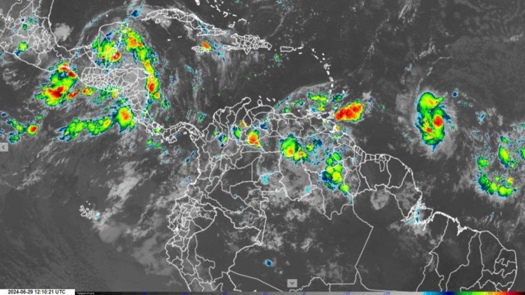
Photo:Ideam
Is Beryl already impacting Colombia and what actions are authorities taking?
Currently, according to the report at 8 a.m. on June 29, a significant wave height of 1.0 to 1.9 meters is observed within the Caribbean Sea with east-northeast winds and an intensity of 10 to 22 knots. In that sense, for the moment, there is no direct or indirect influence of tropical storm Beryl and no impact is expected within the next 48 hours in the national territory.
However, as a preventive measure, the government activated the National Response Plan for Tropical Cyclones, and Ideam “suggests keeping protocols, contingency plans and all response preparation actions active, in the event of the possibility of tropical storm Beryl entering the Caribbean Sea.”
Types of tropical cyclone alerts.
Photo:Ideam
The Caribbean will face an atypical hurricane season this year
The severe climate variability the world has seen this year with record-breaking temperatures, deadly floods, heavy rains and extensive droughts looks set to continue, but now with the warning that during the second half of this year we could see an above-average hurricane season, according to estimates by the National Oceanic and Atmospheric Administration (NOAA).
Hurricane season runs from June 1 to November 30 each year. During these dates, weather conditions increase the possibility of tropical cyclones forming, which in some cases become hurricanes when they strengthen.
And each season, NOAA issues a forecast based on the information available about how that season might behave. In 2024, there is an 85% chance of an above-normal season, compared to a 10% chance of a near-normal season and a 5% chance of a below-normal season. In other words, we are more likely to have a season with a greater impact.
Hurricane season will be above normal compared to previous years, according to NOAA.
Photo:AFP
In this sense, what is expected is a total of 17 to 25 named storms (winds of 63 km/h or more) when the normal is 14; a total of 8 to 13 hurricanes (winds of 119 km/h or more) when the normal is 7; and a total of 4 to 7 major hurricanes (Category 3, 4 or 5; winds of 179 km/h or more), when the normal is 3.
Edwin Caicedo
Environment and health journalist
@CaicedoUcros