This week, and as the authorities announced in previous days, the central and south-central areas of the country are experiencing intense rains, a situation that brings with it a series of complications for dozens of families. In times like these, the help of technology can be key, providing useful information to make decisions in potential crisis situations.
This is the case of Google Flood Hub, a platform that allows you to access forecasts of possible floods or river flooding in advance, applying artificial intelligence to prevent damage to people and infrastructure.
Flood Hub, launched in Chile in 2023, and is already operational in more than 80 countries, benefiting nearly 460 million people around the world, including remote regions and areas with limited internet access.
How does Google Flood Hub work?
The platform uses AI to process a variety of publicly available data sources, such as weather forecasts and satellite images. This information is combined with two main models: the Hydrological Model, which estimates the amount of water flowing in a river, and the Flood Model, which predicts the areas that could be affected and the depth of the water.
This combination allows Google to provide river flood forecasts up to seven days in advancegiving people some time to take preventive measures and stay safe.
The steps to use Google Flood Hub
- To access this platform, the first thing you must do is enter the Flood Hub site
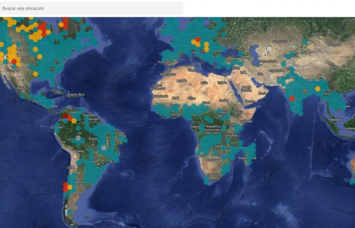
- Once you are inside, a map will open in which different parts of the world are covered by colored dots.
- Once on the platform, various “pins” of different colors will appear that reflect areas where flooding has been recorded. Gray means “no data,” blue translates to “normal,” yellow translates to “elevated,” red translates to “higher,” and brown translates to “extreme.” In this way, you can identify where there are lower or higher risks.
- By clicking on them, you can see the indicators and the forecast for the next few days, as well as how much the water is expected to rise, warning and danger levels.
The origin of this initiative dates back to real cases – such as the Mount Carmel fire in Israel in 2010 – that prompted the Google team to look for ways to improve access to critical information during crises. Since then, the company has dedicated efforts to the development of tools such as SOS alerts, launched in 2017, and flood prediction, which expanded to different countries in 2023. Additionally, Google has presented the AI Sprinters guide so that countries in development take advantage of the potential of Artificial Intelligence.


