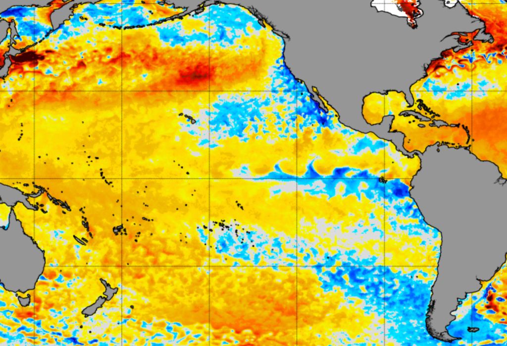

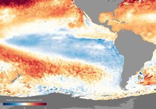
The equatorial Pacific Ocean continues to cool, in its transition from El Niño 2023-2024 towards a La Niña event that has been expected since the beginning of the year, but that It has taken longer than necessary to arrive.
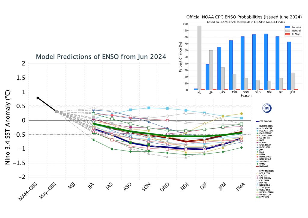
The seasonal forecast published in June by the International Research Institute for Climate and Society (IRI) of the Climate School of Columbia University in the United States, in collaboration with the Climate Prediction Center (CPC) of NOAA, which issues a monthly forecast of the El Niño-La Niña phenomenon, indicates that pfor next quarter JAS (July August September) there is a high probability (>60%) of transition to a La Niña phase.
La Niña is approaching: signs of change in the Eastern Pacific
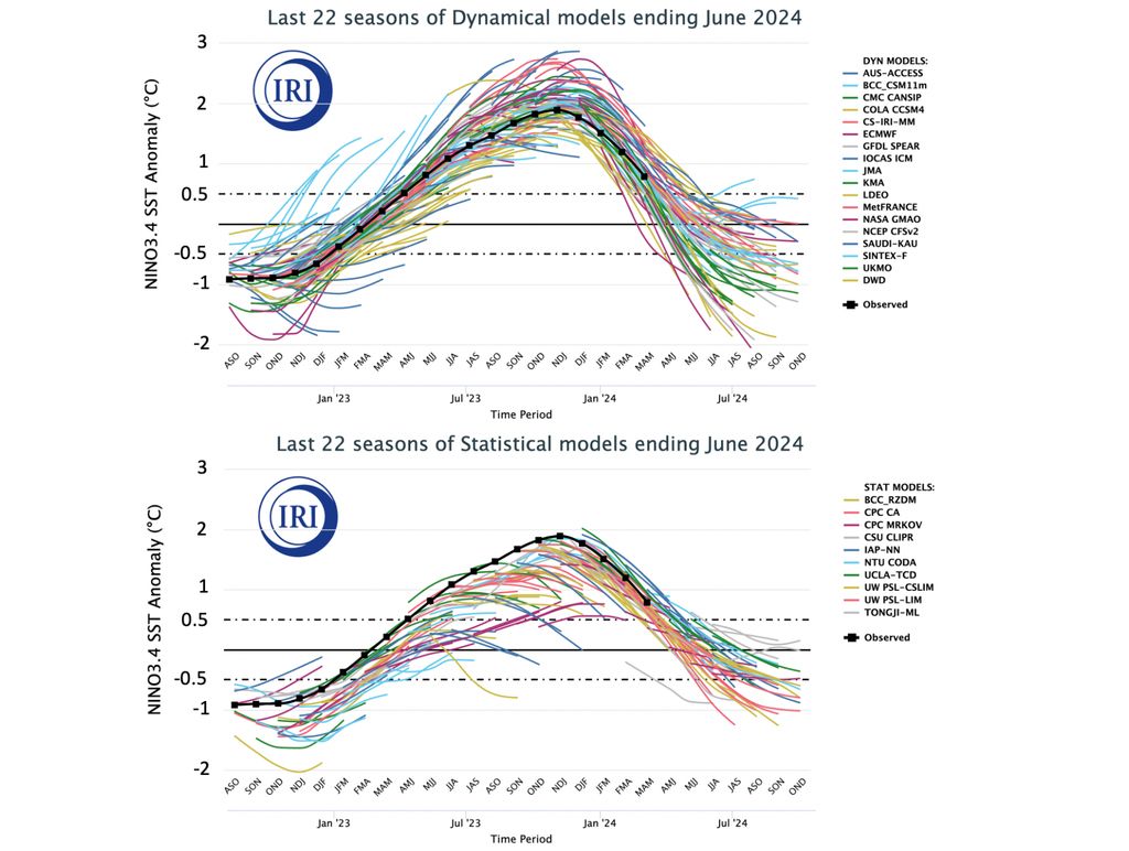
In addition, it is indicated that it is very likely that La Niña conditions will persist until the first quarter of next year, which is the maximum limit of the forecast issued. However, the intensity would not be crazy. The CPC consolidated forecast (represented by the thick blue curve) predicts that, at its peak, La Niña could reach an anomaly close to -1°C, staying mainly between -0.5 and -1.0°C, which would be classified as a weak La Niña.
The models for their part (thick green and red curves) They are more measured regarding coolingsurpassing the -0.5°C barrier only towards the SON quarter (September-October-November).
An inconsistent forecast
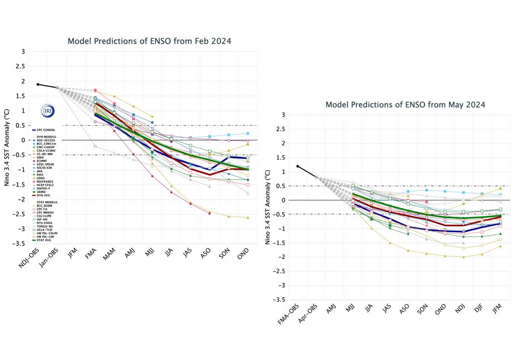
Climate models have not been very consistent with their forecasts. If we go back to the forecast issued in February, the dynamic models estimated the transition to La Niña for the JJA quarter (June-July-August) and the MJJ quarter (May-June-July) already with negative anomalies in the equatorial Pacific; something that has not happened yet, and we are at the end of June.
Less violently they predicted the drop in temperature in their May broadcast; However, the consolidated forecast did give La Niña conditions for JJA. For reasons that would be very interesting to study in detail, the models have been delaying the establishment of La Niña and its magnitude. This could have had an impact on the seasonal forecasts that indicated with great certainty below normal conditions in the rain (typical in La Niña events) but that were very far from being fulfilled.
In addition to this change in the onset and magnitude of La Niña, the models have biases that are always good to know. Dynamic models, for example, during the peak of the 2023 El Niño event yesgreatly overestimated its magnitude. Some models even estimated anomalies above 2°Csomething that was not corroborated.
With respect to the statistical models, they have been underestimating the anomaly values since 2023. They have systematically predicted vminor anomaly values (colder) of what he has ended up observing.
It is possible that the underestimation of anomalies by statistical models has contributed to the perception of an early arrival of La Niña in 2024, but it is also likely that physical mechanisms have affected the deceleration of the phenomenon. Future forecasts will undoubtedly be approached with more uncertainty than in the past.


