The history of the city of San Luis Potosi is closely linked with the Santiago River, a tributary that runs from the foothills of the Sierra de San Miguelito and crosses the entire valley of the state from west to east until it ends in lands of The Tinaja in Soledad by Graciano Sánchez where an extensive lagoon was formed.
At the end of century XVI and after precious minerals were found in what is today San Pedro Hillthe Spanish founders decided to locate the main towns in what is now the capital of San Luis Potosí, since at that time it had good availability of water, especially from the Santiago River, hence the oldest neighborhood in the city is precisely the Santiago neighborhood located on the banks of the river.
However, for decades, especially during the viceregal era, the city suffered several floods, until the Plaza de Armas, this occurred due to the abundant rains that generated the overflowing of the Santiago River and other tributaries that crossed the valley, however, the largest was the first.
The history of the city of San Luis Potosí is closely linked to the Santiago River since its founding. Photo: Historical Images of San Luis Potosí
It was until the beginning of twentieth centurywhen the General Porfirio Díaz authorized the then governor of San Luis Potosí Carlos Diez Gutierrez resources for the construction of the “San José” Dam located upstream in the west of the capital of San Luis Potosí and on the slopes of the Sierra de San Miguelitocompleting its construction until September 1903, having a double function, on the one hand supplying surface water to the population and preventing waterspouts from causing the river to overflow.
The construction of the dam had consequences for the flow of the Santiago River, which began to reduce its capacity and only in the rainy season was there a considerable flow or when the dam was released, as well as the eventual disappearance of the La Tinaja lagoon.
Since then and with the growth of the city it became a muddy focus of infection, since many of the city’s wastewater intakes discharged into the river, which no longer had enough liquid and remained stagnant for months, until the governor’s six-year term. Carlos Jonguitude Barrios in the eighties that, following the world trend of that time, decided that the river was going to become “boulevard” and they paved a large part of its bed.
Currently the Santiago River Boulevard It has almost 13 kilometers of extension, having four and up to six traffic lanes in different sections and has become one of the busiest roads in the metropolitan area of the city of San Luis Potosí, transversally crossing the urban area and connecting the Poniente Peripheral with the East.
At the beginning of 2024, the governor of San Luis Potosí Ricardo Gallardo Cardona The expansion work on this road began, and it will pass the Periferico Oriente and continue around 9 kilometers further north to connect with the road to Matehualathe intention according to the president is that from the colonies to the west of the capital you can reach the “Ponciano Arriaga” International Airport directly and without a single traffic light.
Currently, the Río Santiago Boulevard has almost 13 kilometers in length, having four and up to six traffic lanes. Photo: Special
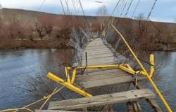
It should be noted that the Santiago River occasionally revivesprobably due to climate change and the extreme drought that is already common in San Luis Potosí, it happens less and less frequently, but when there is significant rain, it implies that the “San José” Dam fills in its entirety and this results in result in opening the gates of this reservoir to release water into the river, causing flooding and a closure of life.
When the floodgates open and the water descends into the river that currently serves as a road, a protocol established between Interapas, the San Luis Potosí road police and Soledad de Graciano Sánchez enters, who proceed to close the access to the road. Although nothing like this has currently happened, it has been reported that vehicles are trapped in the flow and the drivers must be rescued in boats by the corresponding authorities.
Read more: PHOTOS. This is how the Arena Potosí is progressing, when is it inaugurated?
Governor Carlos Jonguitud Barrios in the eighties decided that the river was going to become a “boulevard” and they paved a large part of its bed. Photo: Special


