


After the brief pause on Wednesday (19), heavy rains will return to the country. A new frontal system with an atmospheric river arrives in Chile, which will be accompanied by strong winds and abundant rains.
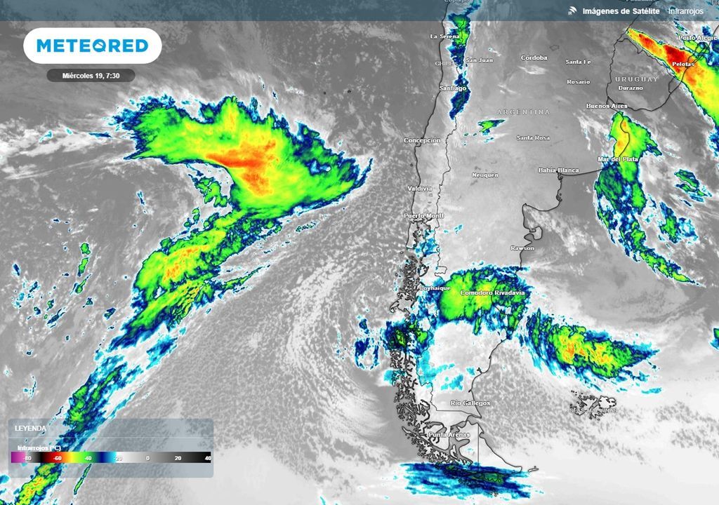
Already the second front system is coming scheduled for this week. The satellites already show the band of clouds moving in the direction of the regions of central and southern Chilewhere the front system will arrive accompanied by a atmospheric river category 2 to 3whose intensity scale goes from 1 to 5.
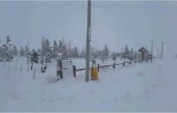
He front system moves guided by a intense jet stream that is crossing the center and south of the country, which will provide strong winds in the mountain sectorwhere they will develop blizzards with the passage of the cold front.
According to the most recent projections provided by the model from the European Center for Medium-Range Forecasting (ECMWFfor its acronym in English), the rains could add more than 100mm sectors of the south of the Metropolitan Region and from Valparaíso to the La Araucanía Region.
The front system will initially advance with a zero isotherm between 1,500 to 1,900 m in the south of the country, and which will be located between 2,000 to 2,500 m in sectors of the central south.
Let us remember that the zero degree isotherm It is the imaginary line in height that limits solid and liquid precipitation. Above the level of the zero isotherm, precipitation tends to be of the snow type, while Under the zero degree isotherm, precipitation is rain or rain showers..
The arrival of cold air during the day Friday (21st) it will descend the zero degree isotherm in the south center to 1,500 to 1,600 m. Rains in the central north are predicted with a zero isotherm at an altitude of 2,000 to 2,300 m altitude.
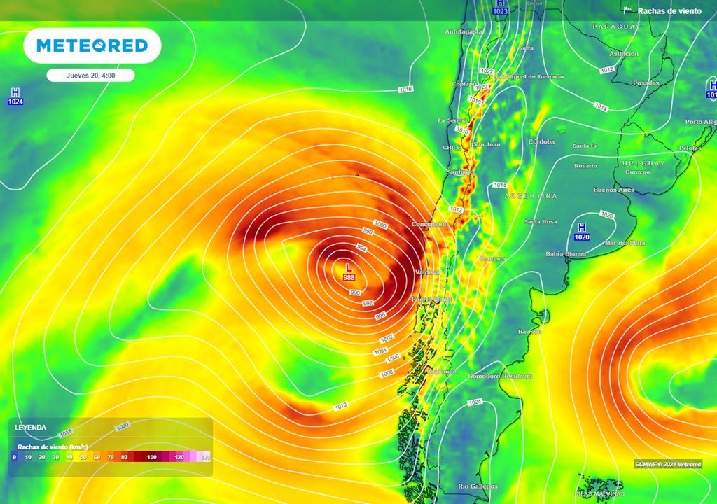
Gusty winds are expected in the preview of the frontal system
He extratropical cyclone or low pressure center will reach the coasts of the country in the Thursday morning (20th). In his advance, the wind will leave gusts of between 70 to 80 km/h on the southern coast of the country. Interior sectors of La Araucanía, Biobío and Ñuble They will also present winds of moderate to strong intensity, which may even reach 90 km/h in some sectors.
In his advance towards centerthe frontal system will not provide winds as powerful as in the south: the maximum gusts in valleys and Maule coast to the north they should range between 50 to 60 km/h between early morning and Friday morning.
When and where are the heaviest showers expected?
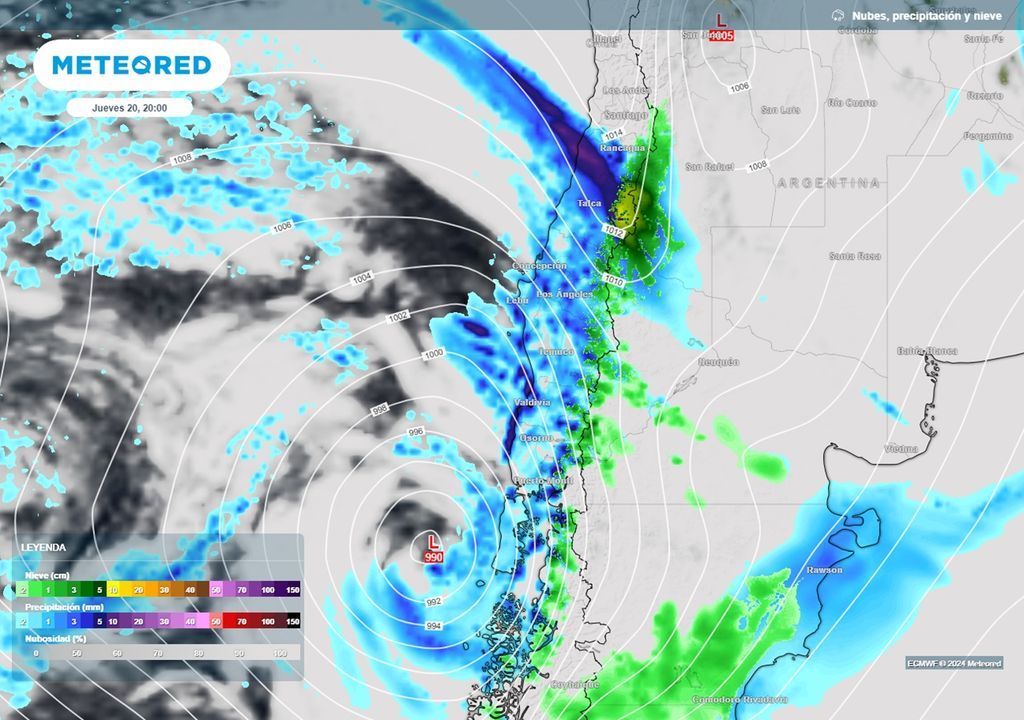
The first rainfallweak, associated with the advance of this frontal system are expected since the early hours of this Wednesday night (19). As the morning advances, the showers will intensify in sectors of the Nahuelbuta mountain range, in the Biobío. During the morning of Thursday (20th) it is expected precipitation rates between 6 to 8 mm/hwith the potential to cause street flooding in some cities.
In the afternoon, the heavy showers will advance towards the Maule, being able exceed 10 mm/h in sectors of the coastal mountain range of the region. SENAPRED maintains preventive early warning for the area, with moderate possibility of mass removals in sectors of the coast, longitudinal valley and foothills.
Overnight, the most active part of the front will move through O’Higginsreaching the Metropolitan and Valparaíso regions with intense showers during the early hours of Friday.
It is expected that the frontal system will arrive, more weakened and with less moisture input, at the coast and southern interior sector of Coquimbo on Friday afternoon. However, some sectors, such as Salamancathey can register heavy showers in the Saturday morning (22).
Snow is once again a highlight in this frontal system
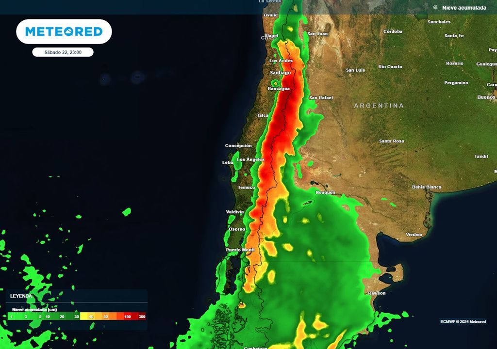
He postfrontal cold will leave options for the fall of Snow Showers the high points of the coastal mountain range of the Valparaíso and Metropolitan Region. The transverse valleys of the portion southern Coquimbo Region They also expect snowfall with the advance of cold air, where it can accumulate between 10 to 30 cm of snow.
In the Ñuble, Maule and O’Higgins mountain rangethe front system can provide between 150 to 200 cm of new snow.
In it South of the countrythe Coastal Range You might also get a few inches of snow with the passage of this front system.


