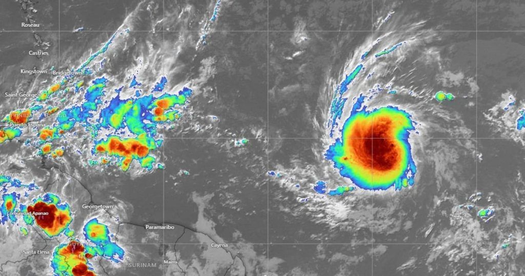
Tropical Depression Two in the Atlantic Ocean evolved into Tropical Storm Beryl the night of this June 28th.
Its center is located 1,785 km east-southeast of Barbados and 4,805 km east-southeast of the coast of Quintana Roo. It has maximum sustained winds of 65 km/h, gusts of 85 km/h and moving west at 30 km/h.
The National Meteorological Service (SMN) indicated that At the moment it does not represent a danger for Mexico.
According to the Subdirectorate of Meteorological Studies and Forecasts of the Secretariat of Civil Protection of Veracruz, it is expected to move through the Windward Islands on Sunday night or early Monday and become a hurricane in a couple of days.
Although Tropical Storm Beryl does not represent a risk for the Mexican coasts at this time, heavy rains are expected in the southeast and west of Mexico over the weekend.
The forecast weather conditions are due to a low pressure zone with a probability of cyclonic development associated with tropical wave number six that will enter and slowly move across the Yucatan Peninsula, in interaction with the monsoon trough extended over southeastern Mexico and with low pressure channels over the north, northwest, west and center of the country.
In light of this low pressure zone, called 94L, prevention and preparation actions were established with the state Civil Protection units of Tamaulipas, Nuevo León, Veracruz, San Luis Potosí, Puebla, Oaxaca, Chiapas, Tabasco, Campeche, Quintana Roo, Hidalgo, Tlaxcala, Mexico City and the State of Mexico.
The National Civil Protection Coordination (CNPC) will deploy ECO Missions to coordinate actions between the federal government and the entities where the low pressure zone 94L is expected to have an effect.
– Occasional torrential rains (150 to 250 mm) in Campeche, Chiapas, Quintana Roo and Yucatán
– Heavy rains in Colima, Jalisco, Nayarit, Oaxaca, Tabasco and Veracruz
– Very strong rains in Aguascalientes, Chihuahua, Durango, State of Mexico, Guanajuato, Guerrero, Michoacán, Puebla, Sinaloa, Sonora and Zacatecas
– Heavy rains in Mexico City, Hidalgo, Morelos, Nuevo Leon, Queretaro, San Luis Potosi, Tamaulipas and Tlaxcala; showers in Coahuila.
– Isolated rains (0.1 to 5 mm) in Baja California and Baja California Sur.