With the purpose ofThe El Niño phenomenon and 65 percent probability of the arrival of The girlbetween July and September, from entities such as the Institute of Hydrology, Meteorology and Environmental Studies of Colombia (Ideam) have warned of the need to begin preparing for the effects it may have on the country’s climate.
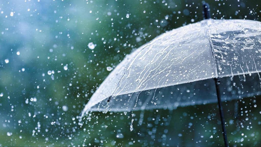
The entity has announced that the presence of La Niña during the second half of the year will significantly influence both the tropical cyclone season and, when interacting with the second rainiest season in the countrywill cause an increase in precipitation above normal climatological amounts.
EL TIEMPO spoke with him Lieutenant Colonel Jorge Giovanni Jiménez Sánchez, deputy director of meteorology at Ideamabout what is known so far about the development of this climatic event in the Pacific Ocean, its possible duration, the regions that will be vulnerable and what may come for Colombia’s climate in the coming months.
What is known so far about the development of the La Niña phenomenon?
For now what the models tell us is that There is a 65 percent probability that the La Niña phenomenon will begin in the quarter of July, August, September. Probably around August will be the month where we will begin to see this change in conditions and from there the probabilities are much higher throughout the course of the second half of this year. This will be the predominant phenomenon in the rest of 2024.
What can we expect from this event in terms of intensity and duration?
What the global models tell us is that it is not going to be such a long-term phenomenon. In fact, the predictions have been adjusted in recent months and the intensity has varied, it has decreased. At this time we expect it to be a weak to moderate phenomenon, more towards the weak category, and its extension will, for now, probably until the first quarter of 2025.
La Niña will be the predominant phenomenon in the rest of 2024.
Photo:iStock
We do not expect it to be as long as the previous one (2020-2023), however it is also important to note that due to the action of the climate change The conditions we have at a global level are not the same as any other Niña that has occurred. We have been experiencing warming above normal since 2023 throughout the planet, in the oceans, and that puts different conditions for the development of the phenomenon.
What impact will this La Niña phenomenon have on the hurricane season?
The La Niña phenomenon is favorable for the development of tropical cyclones. Usually when there is a Niña the amount increases, but this year in particular, as we have warmer oceans, which means an accumulation of energy in the oceans – the main source of food for tropical cyclones – we expect that this season will be much more active than what normally occurs.
It is forecast that if the normal average of hurricanes and tropical cyclones is around 14 in a season, this year, with La Niña, it will be around 20. We are going to have a lot of activity from tropical waves, which are what initiate cyclones. Not all of them become cyclones, but conditions in the national territory do change.
Its passage causes an increase in cloudiness and precipitation, and from September to November, which is where the peak of hurricanes is occurring, we are going to have the La Niña phenomenon, the peak of tropical cyclones, the second season with the most rain for some part of the national territory. This will obviously cause considerable excess precipitation that will mainly affect the Caribbean, Andean and Pacific regions.
Are historical rainfall records going to be surpassed?
In some ways, this upcoming La Niña phenomenon is similar to what happened in 2010, the year in which we also made a rapid transition from Niño to Niña. At that time we had many rivers overflow in Bogotá, such as the event in which the Universidad de la Sabana, in Chía, was flooded. We had many disasters associated with rainfall in the national territory.
Something similar is what we are expecting during 2024, when we will have the impact of these three phenomena on the territory. That is why it is important that there is preparation for the arrival of that season.
What are the vulnerable regions before the arrival of La Niña?
Statistically, when there is a La Niña phenomenon, its relationship with meteorological variables is an alteration of the precipitation amounts that will be above or much above normal. This is particularly true for the Caribbean, Andean and Pacific regions.
We must also consider that we are coming from an El Niño phenomenon that leaves a vulnerable territory, weakened plant coverage, which with the arrival of rainfall will cause floods, earth movement phenomena, landslides, torrential floods. Phenomena that must be taken into account to take preventive actions.
ALEJANDRA LÓPEZ PLAZAS
SCIENCE EDITING
@malelopezpl | @ScienceTime