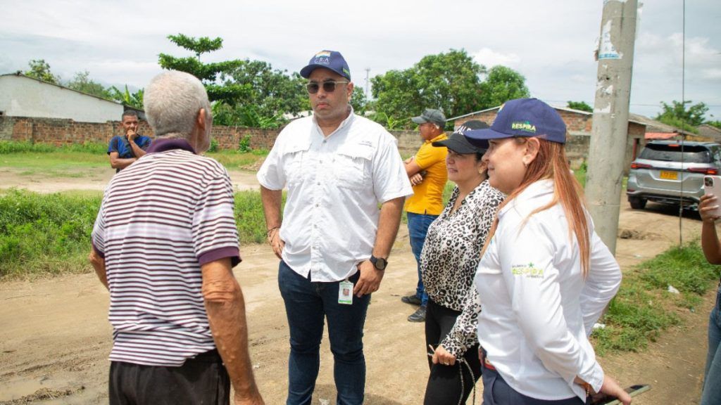
With the purpose of identifying critical points and avoiding an emergency before the arrival of the first rainy season, associated with the hurricane season and the possibility of the presence of the La Niña phenomenon in the region, the Atlantic Regional Autonomous Corporation (CRA), has been socializing with the mayors of the municipalities of Sabanagrande, Campo de la Cruz, Repelón, Juan de Acosta, Baranoa and Usiacurí, a map of flood susceptibility and mass removal.
Jesús León Insignares, director of the CRA, indicated that during the visits made to the municipalities, the mayors have expressed to him the problems of sedimentation, “the mayors have expressed to us problems of sedimentation in the tributary micro-basins that finally reach our large hydrographic basins, loss of hydraulic capacity in some streams and bodies of water, and the presence of blockages by aquatic plant material.”
He assured that the CRA has a technical team that is advising and accompanying the municipalities to identify critical points with the purpose of establishing a social cartography “that allows us to be clear about where the susceptibility, threat, vulnerability and risk are located. in the different areas of the territory”.
The critical points identified with their respective maps were sent to the Undersecretary of Disaster Prevention and Attention of the Atlantic Government for the relevant actions.
Sabanagrande: According to the flood threat map, approximately 60% of the municipality’s urban area is at high and very high levels.
– The area of greatest vulnerability is identified in the homes located between Calle 1 and Carreras 4 and 13 in the direction of the dam that separates them from the swamp system, where, in addition, many of these have been built ignoring current and applicable regulations. .
– There is clogging of the roads, canals and drainage streams of the municipality that prevent the correct evacuation of rainwater.
– It is also reported by the municipality that the tractor pumps and electric pumps that carry out the evacuation of runoff waters towards the swamp system are insufficient in the face of intense rains.
Campo de la Cruz: According to the flood threat map, the entire municipality is at a very high level.
– Currently, there is clogging of the canals and streams that carry out storm drainage in the urban area, particularly in the La Esperanza, El Piñoncito, Carmen and El Diluvio sectors, which has been generating flooding in periods of rain, aggravated by the lack of a collection and evacuation system for these drains, so some owners of properties where the discharge is carried out, being affected, have installed barriers, which aggravates the situation.
Repelón: According to the flood threat map, the municipal seat is at a high and very high level; likewise, according to the mass removal threat map, the rural area with undulating relief presents a high and very high.
– Particularly, as stated by the mayor and his work team, in the town of Cien Pesos there is a critical situation due to the threat of overflowing of two streams that would directly affect the community, which is why it is given a category urgently for your attention.
– The road to the Cien Pesos township is affected by the loss of the bank.
– The Bartolo stream presents sedimentation and when it rises it affects the Las Claritas neighborhood.
– The stream in the Villa Carolina sector presents sedimentation and its overflow has been affecting the Villa Carolina CDI and surrounding homes.
Usiacuri: – According to the threat map due to mass removal, the urban area of the municipality is at a high and very high level.
– It is reported by the municipality that flooding has occurred due to the overflowing of the Cajón stream in the Robles, La Cruz and Isabel Lopino neighborhoods. The declaration of public calamity in the municipality is being considered.
– The mass removal processes that occur in the La Floresta, Las Delicias, Bellavista neighborhoods, sectors of Carrera 15, Carrera 17 Calle 8c, the Main Church and the police station, have been reactivated with the rains. The Corporation has monitored this situation and generated a technical report in 2023 in which recommendations were given to mitigate the threat, such as avoiding water infiltration into the soil as much as possible, restoring plant coverage, verifying the hydraulic installations and carry out a detailed geotechnical study to determine the most appropriate solution for each case.
– There is sedimentation and reduction in the hydraulic section in the El Pueblo, Santana – Tropezón and Mamón streams, which generates the risk of overflow.
Baranoa: According to the flood threat map, most of the municipality is at a moderate level. However, the municipality has generated threat maps on a smaller scale where there are sectors, especially in the urban area, with a high and very high threat level.
– In the Chambacú neighborhood, properties and homes have been affected by the flooding of the stream of the same name; intervention is required to clean and/or channel the channel and carry out some protection works.
– The Guariguacia, Perica and Cien Pesos streams present high sedimentation and the presence of solid waste that reduces their hydraulic capacity and generates the risk of flooding.
– In the Sibarco district, there is a high alert for overflowing and flooding of the Grande stream with its two derivations Sibarquito and San Juan, an event that occurred in 2023 and which, if repeated, could affect approximately 150 homes.
Juan de Acosta: According to the flood threat map, the municipal seat and the El Vaivén township are at a high level, likewise, according to the mass removal threat map, the rural area with relief wavy presents high and very high levels.
– Currently, there is damage and a threat of flooding due to the Juan de Acosta stream in the Villa Estadio, Palenque, La Peronilla and Barrio Porvenir sectors, as well as in the El Vaivén district.
– Due to unauthorized interventions in its channel, the Juan de Acosta stream generates changes in the river dynamics that, with the increase in flow during the rainy season, affect new sectors each year, shifting the threat from year to year.
“From the Subdirectorate of Climate Change and Risk Management of the CRA, we are providing permanent support to the territorial entities, as well as working in an articulated manner with the departmental committee and the municipal Risk Management committees,” pointed out the director of the CRA. AVE.
Continue reading…


