afp_tickers
This content was published in
June 28, 2024 – 11:12
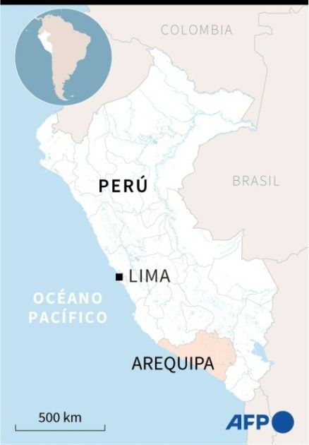
An earthquake of magnitude 7 was recorded this Thursday on the southern Peruvian coast, in the department of Arequipa, without authorities reporting any victims or damages, according to the Geophysical Institute of Peru (IGP).
The earthquake occurred at a depth of 42 km around 00:36 local time (0536 GMT) a little more than 8 km away from the coast of Caravelí, 780 km south of Lima.
For its part, the United States USGS assigned the earthquake a magnitude of 7.2, ruling out a tsunami.
The Navy’s Directorate of Hydrography and Navigation had initially issued a tsunami warning, which was later lifted by the Peruvian authorities.
The shaking was felt in Lima and much of the southern and central coast of Peru.
The town of Chala, with a population of around 10,000, is 41 km from the epicentre, and Yauca, with a population of 2,000, is also in the area.
The mayor of Yauca, Juan Aranguren, described to RPP radio that in his town “there are some walls of houses that have fallen” and that the Pan-American highway that passes through the area has been affected with some cracks.
“The children were crying, the earthquake was strong,” said a resident.
“I want to reassure everyone. The earthquake has passed, we are making the first assessments and so far there are no fatalities to mourn,” Gustavo Adrianzén, chief of staff, told RPP radio on behalf of the government.
“We have ruled out any tsunami warning. A possible tsunami is ruled out,” she stressed.
The head of the IGP, Hernando Tavera, pointed out that it was “a fairly intense movement of the ground which has caused the population to leave their homes.”
The person in charge clarified that the tsunami alert issued a few minutes after the earthquake was a preventive measure given that the epicenter occurred at sea.
Civil Defense and the government activated their emergency plans, carrying out the corresponding monitoring to assess the damage and determine the actions to be taken.
Peru, with about 33 million inhabitants, is located in the so-called Pacific Ring of Fire, which extends along the west American and east Asian coasts.
In these regions, the highest seismic activity in the world is recorded, with at least a hundred earthquakes perceptible to the population per year.
cm-ljc/en


