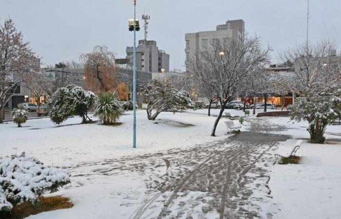
This Thursday June 20 It will be a day marked by extreme weather conditions in large part of Neuquen and Black river. Some meteorologists even announce that it could be a “D-Day”marked by unusual snowfalls that could touch the Alto Valle. Here, we tell you What are the conditions that make this day so special.
A big snow storm is coming this Thursday, just the day astronomical winter begins in the southern hemisphere. At the moment, a yellow alert from the National Meteorological Service (SMN) throughout the center – west of Neuquén, mountain range and southern region of Río Negro.
«A high-impact event is expected with significant snowfall covering a large area of central and northern Patagonia. Snow accumulations will be relevant even in urban sectors. Extreme snowfall will then follow in the northwest mountain range of Neuquén and Cuyo“said the meteorologist Enzo Campetella In a recent article published in Meteored.
As detailed, where the most extreme conditions will occur will be in the towns of Bariloche, Villa La Angostura, San Martín de los Andes, El Bolsón and Esquel. Here the highest levels of accumulation will take place.

But, What will happen to the Upper Valley? According to Campetella, the area “will be at the northern limit of the system, so there Some showers are expected, which could eventually be sleet in the early hours of the day.although that probability is somewhat greater on the south wall.
Campetella also highlighted the roads that could be covered by snow. «Routes 40, 237, 25, and 26 could be significantly affected«. Likewise, some sections of the Route 22 between Cutral Có and Zapala could receive accumulated.
Why this Thursday is “D-Day” for snow in the Alto Valle: what conditions will exist
Patagonia is being affected these days by a “low pressure system”, which has its origins in the Pacific Ocean. «As it moves eastward (the low pressure system) begins to interact with a very cold air mass of polar origin that has helped her advance towards northern Patagonia«Detailed the meteorologist.
For Thursday morning this low will be positioned off the Chilean coast, with a central value of 985 hPa, which makes it especially deep generating intense winds in its area of influence.
«On the Argentine side, this circulation will be mostly from the east or northeast, ensuring the contribution of oceanic humidity to the region. And here is the interesting thing about the situation. Although it may sound strange to a non-meteorologist, this snowfall is generated by a warm front. This is because the low ahead has a warm front that extends into Argentine territory. What happens there is that somewhat warmer and more humid air is forced to rise above the cold air mass of polar origin that covers the region.«added Campetella.
And I add: «This is how the moisture present in the warmer mass, when precipitating on the colder air below, reaches the surface as snow.. This type of snowfall is usually very productive in terms of amount of snow, and because it is blown from the east, in “Some areas of Patagonia are known as Nevadas de Below, because of the wind that comes from the sea.”
With information from Meteored

