
The satellite image shows abundant cloud cover across the entire northern half of the country. In some areas the cloud tops are quite high. However, they are not producing precipitation at the moment, nor are they expected. These tops are formed by the entry of cold air at altitude, which will also begin to enter the surface in the next few hours.
This cold air will enter as a strong wind from the southwest, with gusts that could exceed 50 km/h. This way, we will have a weekend with good weather, but with winter temperatures.
time 2.png
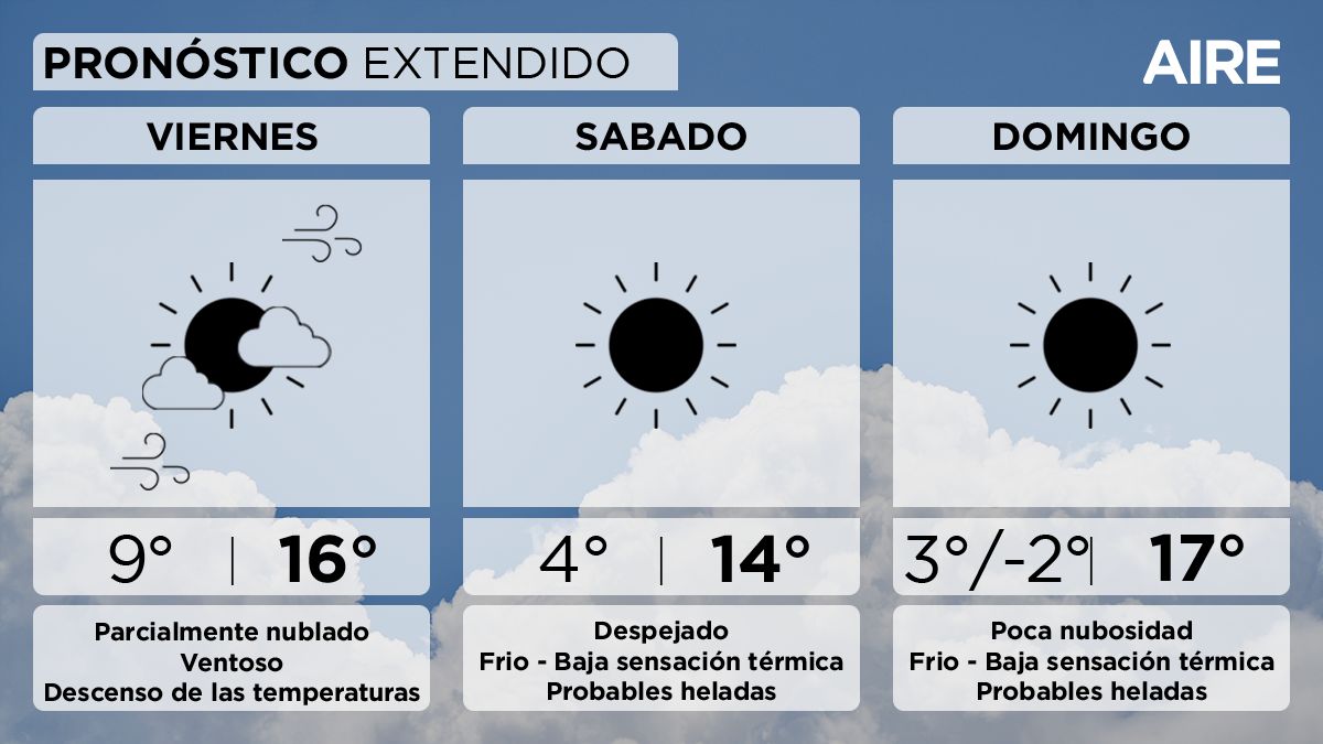
Extended forecast: Friday with a drop in temperatures
This Friday will be partly cloudy in the city of Santa Fe. Minimum temperature of 9°, maximum of 16° and light to moderate wind from the southwest, with possible gusts of greater intensity.
time.png
Saturday: probable frosts
On Saturday, there will still be a strong southwesterly wind in the early hours, which could prevent frost from forming despite the drop in temperatures and clear skies.
Minimum temperature of 4° with low wind chill and possible frost, maximum of 14° and light to moderate wind from the southwest.
Sunday: minimum of -2°?
Sunday will continue with clear skies or with few clouds. Minimum temperature of 3° in urban areas, -2° with frost in areas with few buildings, maximum of 17° and light to moderate winds rotating to the north.
#Argentina


