


After warm temperatures that surprised many, this Monday the cold returned with everything in the northern region of Patagonia. Starting this week it will be produced again a sharp drop in temperatures in Neuquén and Río Negrowhich will come with alerts for snow and wind, according to the National Meteorological Service (SMN). For its part, the AIC reported that in the Valley the entry of polar air will continue with minimum temperatures that will reach -3°C.
From the National Meteorological Service (SMN) They issued a yellow alert for snow for this Monday and Tuesday in the Rio Negro and Neuquén mountain range.
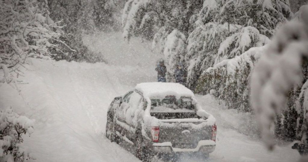
The last part of the organization expects “snowfalls of varying intensity, some heavy, with accumulated between 30 and 45 cm, which can be surpassed occasionally“, without ruling out the occurrence of mixed rain and snow in lower areas.”
However, for some sectors an orange alert applies, where a “accumulated between 40 and 60 cm.”
Snow alert in Neuquén: the sectors it will affect
The lakes: In this region, which includes, for example, towns such as Villa La Angostura and Villa Traful, the yellow alert will be in effect from Monday morning until Tuesday morning.
Huiliches Mountain Range – Lácar Mountain Range – South of Aluminé: The alert in this area, where towns such as San Martín de los Andes and Junín de los Andes are located, will extend from Monday morning to Tuesday morning.
Aluminé Mountain Range – Chos Malal Mountain Range – Loncopué Mountain Range – Minas Mountain Range – Picunches Mountain Range – Ñorquín Mountain Range: The risk of heavy snow ranges from Monday morning to Tuesday night. However, conditions will worsen on Monday evening. In this sector are, among other cities, Chos Malal, Caviahue, Villa Pehuenia and Andacollo.
Wind alert in Neuquén: the sectors it will affect
East of Loncopué – East of Picunches – East of Ñorquín – West of Añelo – West of Pehuenches – South of Chos Malal – South of Minas: The warning is for the afternoon of Monday the 17th.
Snow alert in Río Negro: the sectors it will affect
Bariloche – Pilcaniyeu Mountain Range – Ñorquincó Mountain Range: The snow alert is in effect from Monday morning to Tuesday morning. It includes, in addition to Bariloche, El Bolsón.
What will happen in the Alto Valle
From tomorrow, strong winds and moderate snowfall will continue in southern Patagonia, and they will move northward and reaching the southern strip of Chubut, which enters this day under alert.
As reported by the Interjurisdictional Authority of Cuencas (AIC), in the Valleys, the Meseta and the Atlantic Coast, the entry of polar air will continue starting Thursday. Yoeven, Possible rain and snowfall are not ruled out.
Meteorologist Fernando Frasetto indicated that the fall of snow It will be very close to the valley area.
The impact of this front will be reflected in the minimum temperatures. In Neuquen capital will be placed in the -3°C during Thursday, Friday and Saturday. While the Maximum temperatures will barely touch 10°C. The same will happen on the Rio Negro side, where in General Roca minimum temperatures are expected to be around -3°C.


